How to Read a Property Survey and What It Shows
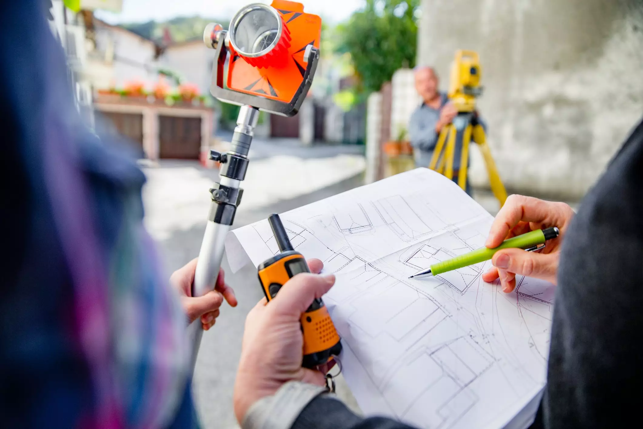
Table of Contents
- How to Read a Property Survey and What It Shows
- What Is a Property Survey?
- Types of Property Surveys You Might Encounter
- How to Read a Property Survey
- 1. Start with the Title Block
- 2. Check the Legend or Symbol Key
- 3. Identify Property Boundaries
- 4. Locate Structures and Key Features
- 5. Check for Setbacks
- 6. Take Note of Easements and Rights-of-Way
- 7. Look for Encroachments
- 8. Review Notes and Certifications
- 9. Walk the Property
- Why This Matters Before You Buy or Renovate
- Common Red Flags to Watch For
- Do You Need a New Survey or Is an Old One Enough?
- How to Get a Property Survey (If You Don’t Already Have One)
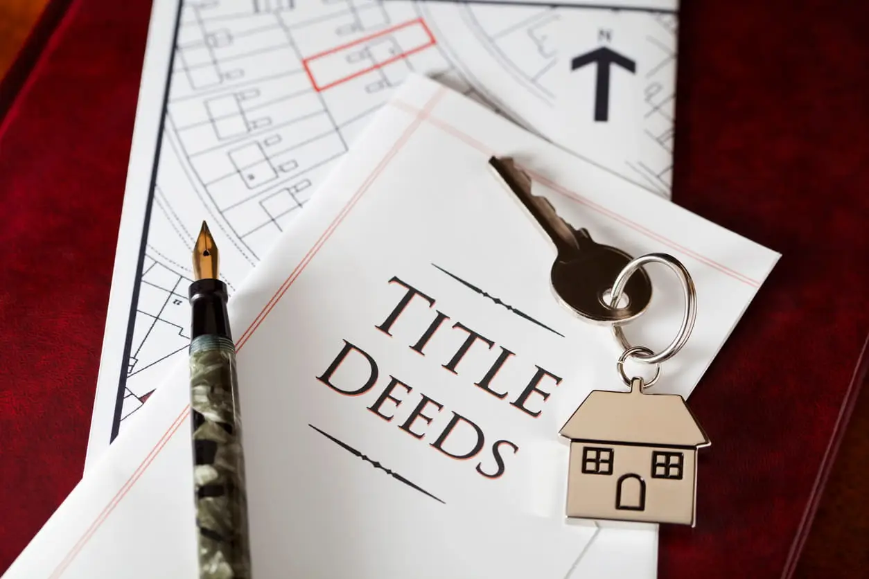
Buying a home is exciting, but it also comes with a bit of anxiety, uncertainty about what you actually own, and a lot of paperwork. One of the most overlooked yet critical real estate documents is the property survey. This document clearly outlines your property, clarifies boundaries, and helps prevent future headaches with lenders, neighbors, or local permit offices.
So, if you’ve ever wondered, “What exactly am I looking at on this survey?”, you are not alone. Let’s help you understand what property surveys are and how to read one.
What Is a Property Survey?
A property survey is a precise, detailed map drawn by a licensed land surveyor that defines the exact boundaries of a piece of land, along with its legal and physical features (structures, easements, rights of way, encroachments, etc.). You can think of it as the blueprint of property lines: it tells you what’s legally yours and what isn’t.
It is important to note that a property survey is not the same as a home inspection (which looks at condition) or an appraisal (which estimates value). Instead, it focuses on land boundaries, legal access, and other things that can affect your ability to build, renovate, or even sell.
Types of Property Surveys You Might Encounter
Depending on your situation, you might come across different types of surveys. Some of the most common kinds include:
- Boundary Survey: Defines exact property lines and is used for purchases, fence placement, or resolving disputes.
- Mortgage/Title Survey: A specific type of boundary survey that is usually required during financing or refinancing and is used to confirm boundaries and improvements for lenders.
- Topographic Survey: Shows slopes, contours, and elevation and is useful for construction, landscaping, and drainage planning.
- Subdivision/Plat Survey: Divides the land into smaller/separate lots and is used for development or zoning compliance.
- ALTA/NSPS Survey: A comprehensive survey done in line with strict national standards (established by the American Land Title Association and National Society of Professional Surveyors). This type of survey is typically used for commercial transactions or high-value properties.
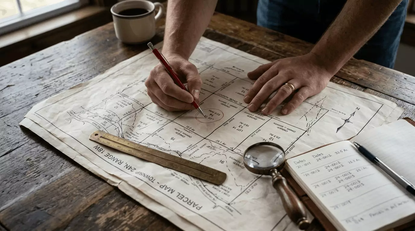
How to Read a Property Survey
A property survey can look like a confusing jumble of lines, numbers, symbols, and abbreviations. However, once you know what to look for, it all starts to make sense. Here are a few tips on how to read and understand your property survey:
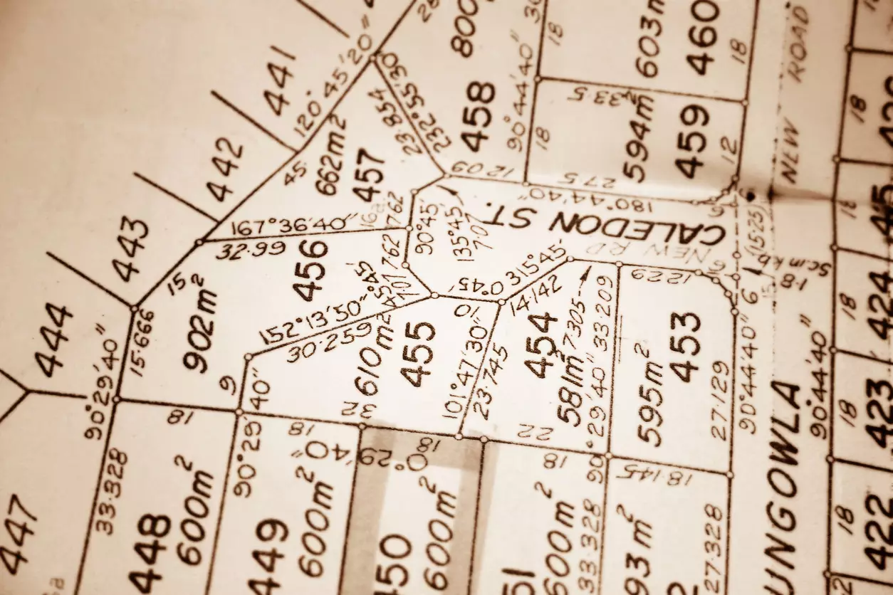
1. Start with the Title Block
This is usually located in the corner of the survey. The title block typically lists key details about the property and survey itself, including:
- The property’s legal description
- The surveyor’s name, seal, and license number
- The date the survey was completed or updated
- The scale used (e.g., 1 inch = 20 feet)
These details help you confirm that you're looking at the correct and official document for your property. They also let you know how recent the survey is and whether it matches your property’s legal records.
If the survey is more than a few years old or predates recent improvements to the property, then it may not reflect current conditions. Likewise, the scale is crucial for understanding the real-world size of everything on the map; without it, the measurements are meaningless.
2. Check the Legend or Symbol Key
The legend explains all the symbols and abbreviations used in the property survey. It is usually located in a lower corner of the document (often in the bottom-right corner) but may sometimes be included in the title block.
Understanding the legend is like reading a map key; without it, the survey is basically a collection of meaningless lines and dots. The legend translates the drawing from technical cartography into understandable information, allowing you to have a clear idea of what’s actually on your land.
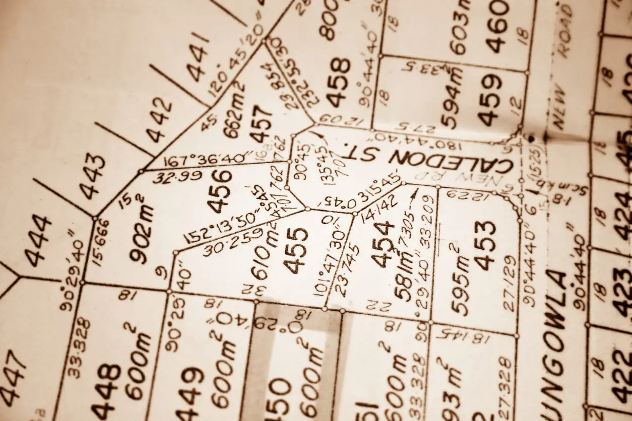
3. Identify Property Boundaries
Look for the thick, dark lines that outline the lot. These are your legal property lines (boundary lines). They are often marked with measurements (lengths and angles) and compass bearings that define each side’s direction and length.
Boundary lines are one of the most important parts of the property survey. They tell you exactly where your land starts and ends, which is crucial for fencing, landscaping, avoiding encroachments, and preventing disputes over what land is yours.
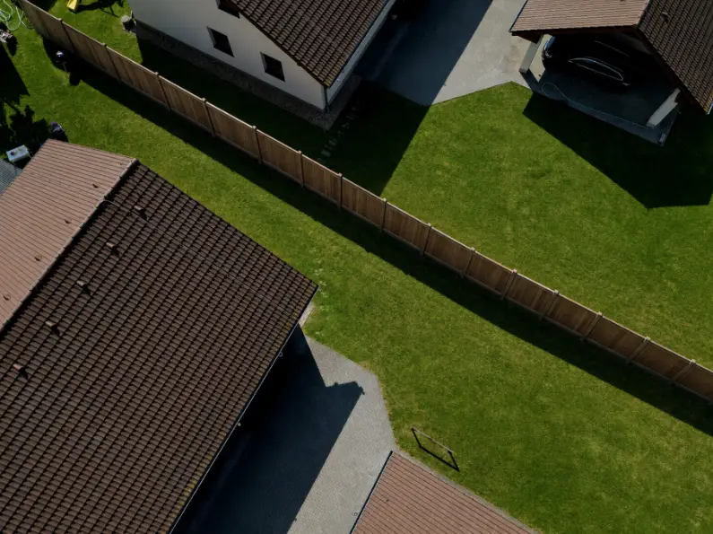
4. Locate Structures and Key Features
Look for labeled rectangles or outlines showing your house and other features or improvements, like a garage, driveway, deck, or pool. Note their position relative to the boundary lines you just identified.
This helps confirm that your house and other permanent structures are within your property lines and comply with local zoning requirements.
5. Check for Setbacks
A setback is the required minimum distance between a structure and a property line. Think of it as an invisible boundary that dictates how close you can build to the edge of your property. They’re often shown as dotted lines inside the boundary (on the property survey).
Setbacks are usually mandated by local zoning codes, and violating them can lead to permit denials or forced changes to your building plans.
6. Take Note of Easements and Rights-of-Way
Easements are areas where other people or entities (like utility companies or neighbors) have legal access or usage rights to part of your land. They are usually shown as dashed or dotted lines or as shaded areas, and clearly labelled.
Knowing where these easements are on your property is critical for any future landscaping or construction projects you intend to undertake. You cannot build a permanent structure (like a shed or fence) or plant trees on an easement.
7. Look for Encroachments
An encroachment occurs when something crosses the boundary into a neighboring property or easement. Scan the area near your boundary lines and look for any structure, like a fence, a neighbor's shed, part of a driveway, or an overhanging tree, that is drawn crossing the property line. The survey will usually have a note directly on it or highlight the area in a specific color.
Encroachment are red flags and can lead to legal disputes, title issues, or problems during resale. It is always a good idea to resolve them before closing on the property; if this is not possible, ensure that it is corrected later through an agreement or removal.
8. Review Notes and Certifications
Read all the text blocks scattered around the survey. They may seem like filler, but they aren’t. These notes are the surveyor's professional conclusions and clarifications. They explicitly state the problems they did or did not find. They also include the surveyor's official certification statement, which is what makes the document a legal record, stating the survey was performed to professional standards.
9. Walk the Property
Once you’ve read your survey, take it outside and walk your property. Use it to find the physical markers (pins, nails) the surveyor placed or found. Doing this helps turn the lines on paper into a real-world understanding of your land.
Why This Matters Before You Buy or Renovate

Reading and understanding a property survey isn’t just about going through the motions; it is vital for protecting your real estate investment. Here are some reasons why this document matters:
- Loan Approvals: Most lenders usually require a survey to confirm boundaries and improvements before financing. Discrepancies can delay or derail closing.
- Permit Restrictions and Compliance: Local building departments rely on surveys to confirm additions meet zoning rules. Building too close to a setback or on an easement can halt your renovation plans.
- Neighbor Disputes: Clear property lines help prevent encroachment claims, arguments over fences, trees, shared driveways, and other similar issues.
- Future Resale: A clean, current survey reassures future buyers (and appraisers) that your property is legitimate and conflict-free.
- Value Risk: Issues like undisclosed encroachments or easements can reduce your property’s value.
- Insurance Limits: Surveys can reveal flood zones, drainage easements, or other access issues that can affect insurance premiums.
Common Red Flags to Watch For
Here are some common red flags to watch out for when reviewing a property survey:
- Fences or driveways crossing boundary lines
- Neighbor’s shed or structure encroaching on your land
- Easements not listed/recorded in title documents
- Flood zone markings or topography warnings that were not disclosed and could affect future construction
- Missing or inadequate legal access to a public road
- Survey date older than 10 years or missing updates
- Missing property corner markers
- Setback violations (measurements from structures to the property line are smaller than the minimum required by local zoning laws)
If you spot any of these red flags, you should ask your real estate agent, title company, or surveyor for clarification. You can also contact your local zoning office if setbacks or easements are unclear.
Depending on the nature of the issue, you have several options: ask the seller to either resolve it (by moving the fence, securing a legal easement, etc.) or lower the price to compensate for the problem, or walk away from the deal entirely. However, no matter the situation, it is always advisable to seek professional advice before proceeding.
Do You Need a New Survey or Is an Old One Enough?
Whether you can rely on an existing property survey largely depends on how old the survey is and what has changed (with the property) since it was created. Based on these factors, you may either get a surveyor’s recertification or need a whole new survey:
- Full New Survey: This is usually required if there have been any constructions or changes (like a new fence, deck, shed, pool, or addition) to a property since the last survey. Full new surveys are also highly recommended before closing on new property purchases and before any major renovations. These surveys can cost anywhere from $400 to $1,500 or more, depending on location, property size, and complexity.
- Recertification (Survey Update): Here, the original surveyor returns to the property to visually verify that nothing has changed since the original survey was completed. If they confirm that there have been no significant changes, they can recertify the existing survey. This option is generally faster and less expensive than a full new survey and may be used in situations where the existing survey is less than 5-10 years old. Note that some lenders or title companies may not accept a recertification.
How to Get a Property Survey (If You Don’t Already Have One)

If you don’t already have a property survey, here’s how to get one (starting this process early is crucial for avoiding costly legal disputes, permit denials, and other major project delays):
- Ask the seller (or your real estate agent). This is the most direct option and typically costs you nothing. Most sellers usually have a recent survey available or know the surveyor. Even if the survey is old, it can still provide valuable information and might qualify for a cheaper recertification.
- Search county GIS or property records. Many counties have online GIS (Geographic Information System) portals where you can look up property surveys, plats, and other related property information. You can also contact local county recorder’s or assessor’s offices to view and copy these documents. Note that fees may apply.
- Check with your mortgage lender or title company. Contact the title company handling the closing or the bank that holds your mortgage (if you're refinancing). They often keep a copy of the survey in their files from when the property was last purchased or refinanced.
- Reach out to the previous surveyor. If you have an old survey, look for the surveyor's seal and company name on the document. Contact that firm directly: if the survey is recent enough, they may be able to perform a survey update (recertification) for a lower fee than a full new update.
- Hire a licensed land surveyor. If all else fails, or if you need a new property survey, then you will have to hire a licensed surveyor. You can get referrals from your lender or title company (be sure to get and compare quotes from at least 2 – 3 surveyors).
A property survey isn’t just technical paperwork, it’s your blueprint for ownership. These documents protect your investment and help you understand your land, where you can build, and how to avoid future headaches. Whether you’re buying, renovating, or simply curious about your property’s true boundaries, take time to read and review your survey. It might just be the most important piece of paper in your property folder.

Elena Novak leads real estate research and analysis at PropertyChecker.com, where she digs into housing trends, tracks property data, and unpacks investment strategies across the U.S. With a background in flipping homes and a degree in Business and Real Estate Development, she brings a practical, hands-on approach to market analysis. Elena is especially skilled at uncovering hidden property value and guiding both homeowners and investors through shifting market conditions. She's also passionate about sustainable design and smart home innovation. When she's not analyzing the market, she's probably knee-deep in a DIY project, scouting vintage décor, or building something new in her workshop.
Search Property & Deed Records
Table of Contents
- How to Read a Property Survey and What It Shows
- What Is a Property Survey?
- Types of Property Surveys You Might Encounter
- How to Read a Property Survey
- 1. Start with the Title Block
- 2. Check the Legend or Symbol Key
- 3. Identify Property Boundaries
- 4. Locate Structures and Key Features
- 5. Check for Setbacks
- 6. Take Note of Easements and Rights-of-Way
- 7. Look for Encroachments
- 8. Review Notes and Certifications
- 9. Walk the Property
- Why This Matters Before You Buy or Renovate
- Common Red Flags to Watch For
- Do You Need a New Survey or Is an Old One Enough?
- How to Get a Property Survey (If You Don’t Already Have One)